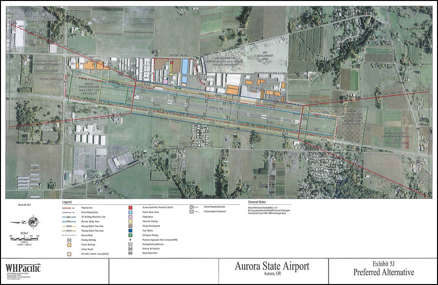
On March 31, the Oregon Department of Aviation recommendation on updates to the Aurora Airport Master Plan was made to the Oregon Aviation Board by ODA staff and their consultant. Of note, the core of the presentation was the explanation of the “Preferred Alternative” which replaces the four alternative found in the draft of Chapter Five of the Master Plan. The “Preferred Alternative” document and its accompanying layout map recommend:
- Change in Classification from B-II to C-II (a classification to accommodate larger and heavier jets) with improved avionics.
- No lengthening of the runway, but a substantial extension of the Runway Protection Zone (RPZ) to the south, including:
- Acquisition of EFU farm land to accommodate the RPZ and run off areas.
- The change of classification to C-II means strengthening the runway to accommodate larger jets.
The problem is that the oral testimony and discussion before the Aviation Board included a substantial discussion of another alternative: the future implementation of a “DIsplaced Threshold” which would result in a 1,000 foot runway extension at the south end of the runway for the purposes of allowing jets to take off to the north with a full load of passengers and fuel in the heat of the summer. If approved, this runway lengthening would bring the south end of the runway to the current south airport boundary. Implementing it would require:
- Further expansion south of the Runway Protection Zone
- Closure of Kiel Road
- The loss of additional EFU farm land, in as much as this would essentially condemn all property between the airport and Ehlen Road as suitable for airport-related development.
Friends of French Prairie opposes any runway lengthening. The Aurora Airport is constrained on three sides by major roads, and to the south by EFU farmland. Sacrificing foundation farmland for runway expansion to benefit less than 1% of the population, and paying for it with taxpayer’s money is not acceptable.
Download the Master Plan Preferred Alternative in PDF here
Download the Preferred Alternative map in PDF here

